
| «Back to Previous Post |
Date: Friday, 7 November 2008 04:30 PST
Subject: Greetings from Cotopaxi National Park, Ecuador
Captions for Pictures:
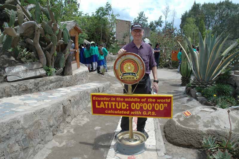
1. At the equator line, just north of Quito
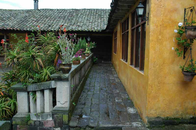
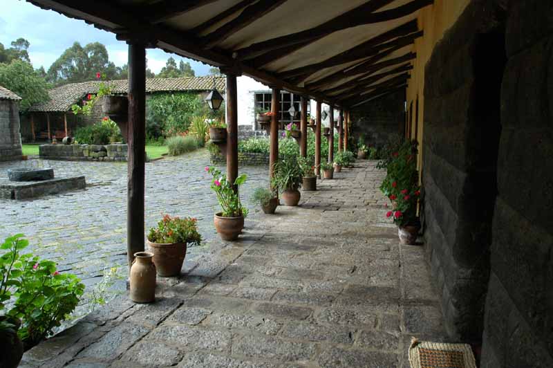
2-3. Hacienda Agustin de Callo, where we stayed
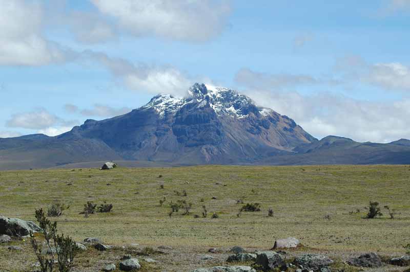
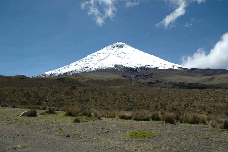
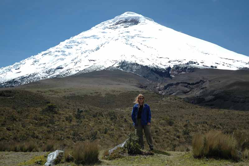
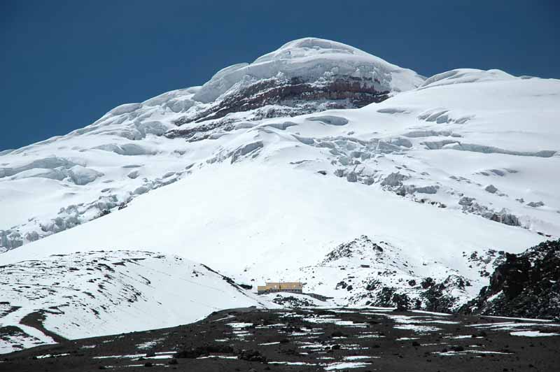
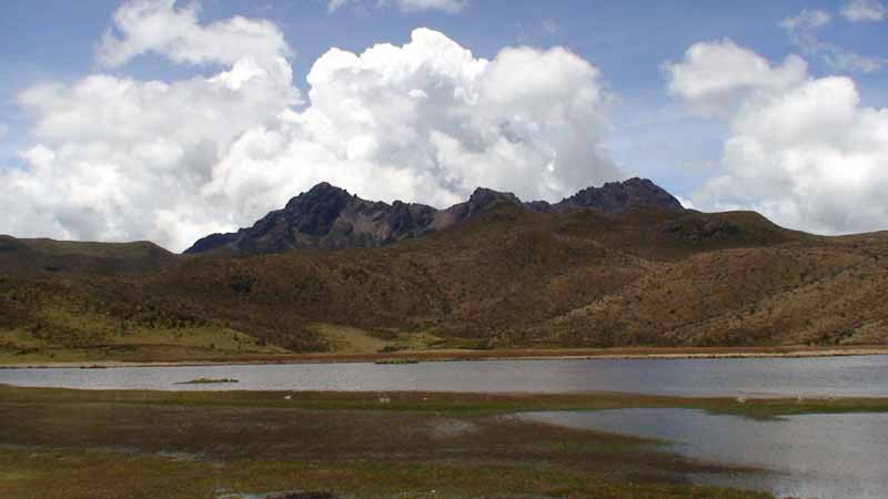
4-7. Cotopaxi National Park and mountain
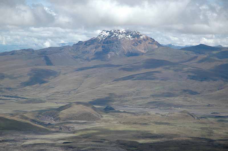
8. Vista from 14,500 feet in Cotopaxi National Park
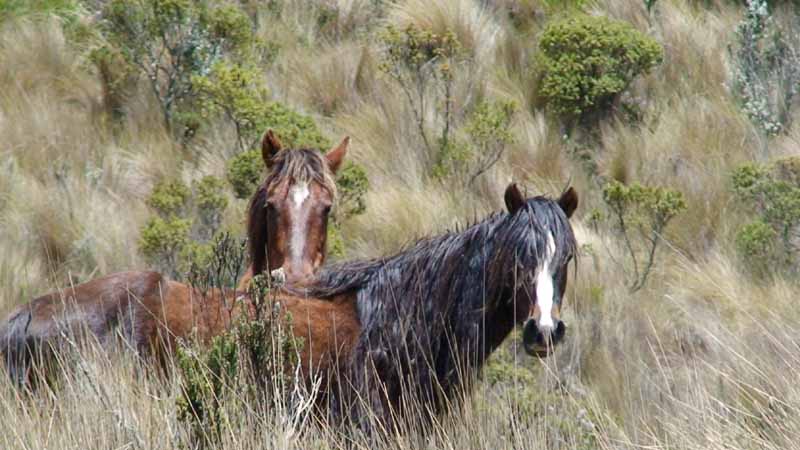
9. Wild horses at Cotopaxi National Park
10. Lake that we hiked around at Cotopaxi National Park
Since we last wrote, we left the hacienda north of Quito on Wednesday and made our way to Cotopaxi National Park about 50 miles south of Quito. We hired a driver to take us between the two destinations, which included a stop at the equator itself, about 15 miles north of Quito. We had heard it was a little “touristy”, but we enjoyed the “tour” that we got for $3.00 a person. It included a water demonstration (it drains straight down right on the equator, counterclockwise in the Northern hemisphere and clockwise in the Southern Hemisphere), and an egg balancing test (supposed to be easier to balance on a nail on the equator).
After an hour there, we drove through traffic rivaling LA in Quito (at 1pm local time) and then finally began to climb again on the south side of the city along the Pan American highway. We reached our destination, Hacienda San Agustin de Callo, in the middle of the afternoon. The dirt road that we were on doubled as a river due to the heavy rain that was falling at the time. This hacienda is built on Inca ruins and many of the guest rooms, the sitting room and the dining room incorporate stones laid in the 1400’s. We settled in for a relaxing afternoon and interesting dinner conversation with Brits, Dutch and an American widower who is sailing around the world.
Thursday, we had an early start as we met a guide and driver who took us to Cotopaxi National Park, about a 45-minute ride by dirt road. The park is home to the Cotopaxi volcano, which at 19,656 feet is the second tallest mountain in Ecuador. We were very fortunate to have some very clear views of the volcano (we were told that it can remain behind clouds for weeks at a time). Our driver took us up to about 14,500 feet where the climber groups leave for their summit attempts. This involves a hike to the Refugio Jose Rivas at about 16,000 before getting up at midnight for the final summit push. We then drove back down to 11,700 feet to a beautiful lake and took a hike around it. We came upon several types of birds, wild horses and lizards. After a picnic lunch, we called it a day and went back to the hacienda. At sunset, we were able to get some fleeting glimpses of the tallest mountain in Ecuador, Chimborazo, at 21,033 feet.
Today we will leave from Quito airport for a half hour flight to the Amazon basin. We will spend the weekend on the Rio Napo, an Amazon tributary to hopefully see some monkeys, parrots and other animals. We are looking forward to the warmer weather there after the past few days in the Andes.
Take Care –
Sandy and Darren
| «Back to Previous Post |